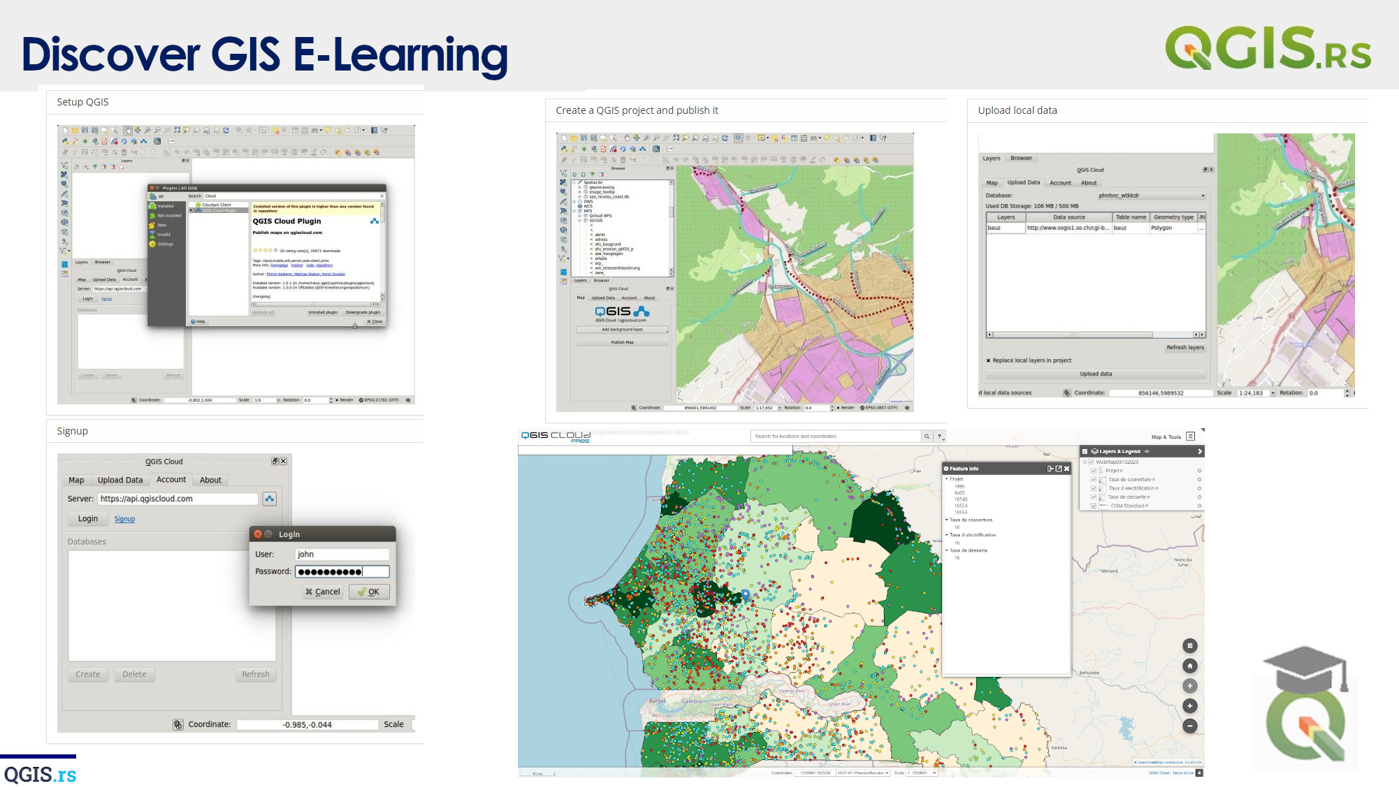
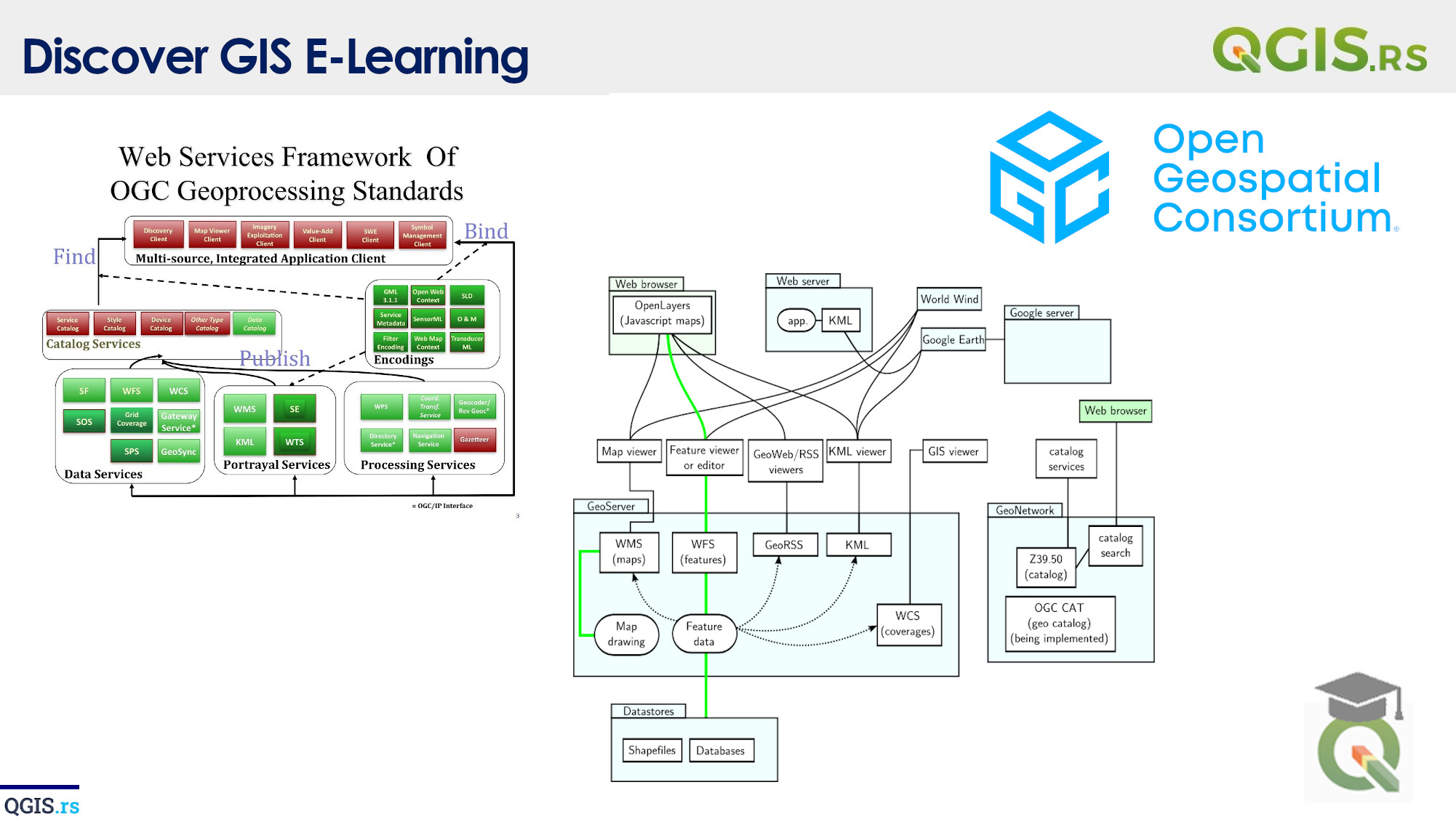
‘QGIS.rs’: Explore WMS services
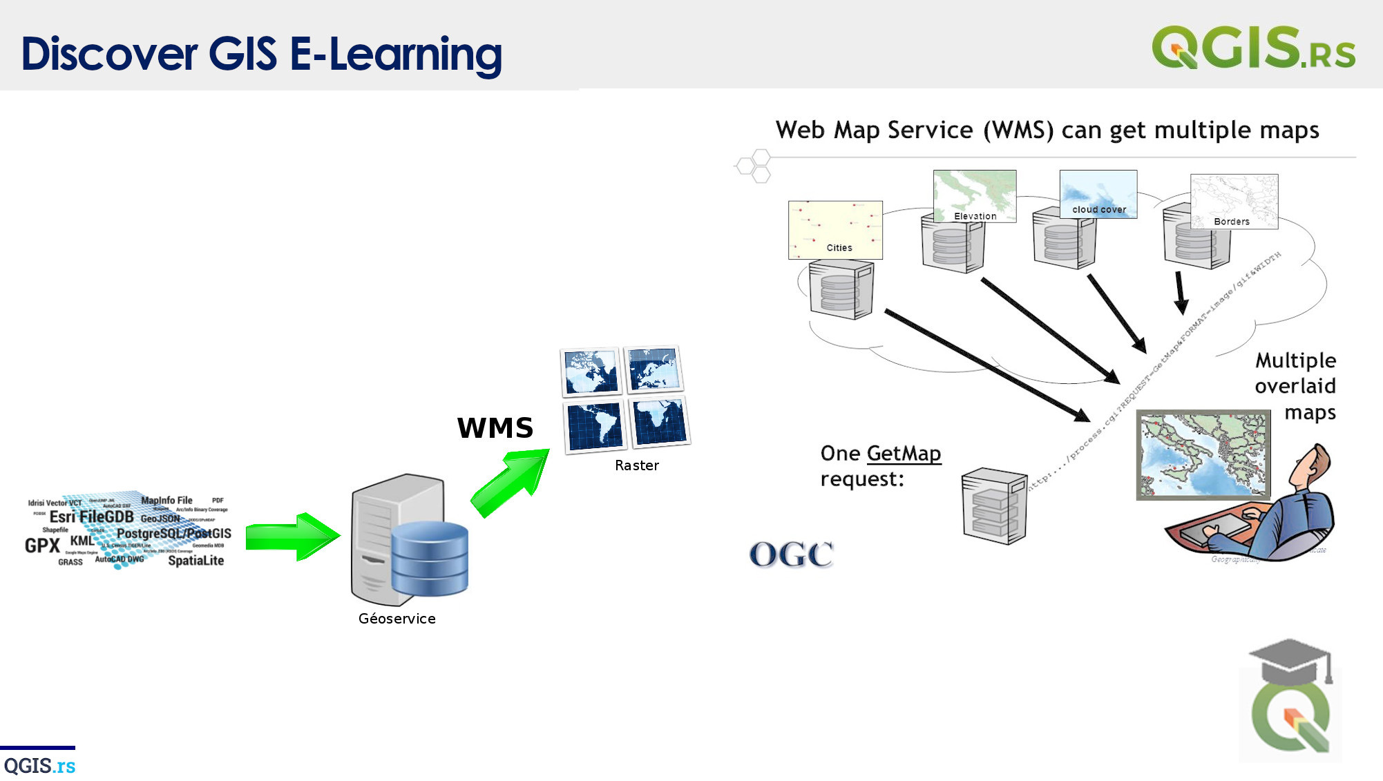
WMS stands for Web Map Service and it's a protocol used for serving geospatial data on the internet. With WMS, you can access and display maps, images, and data from a variety of sources on your own website or application.
“GIS is the eyes of the world, illuminating the dark corners of our planet and helping us see what lies ahead.“ - ChatGPT
march 28, 2022
august 18, 2022
august 18, 2022
august 18, 2022
august 18, 2022
august 18, 2022
august 18, 2022