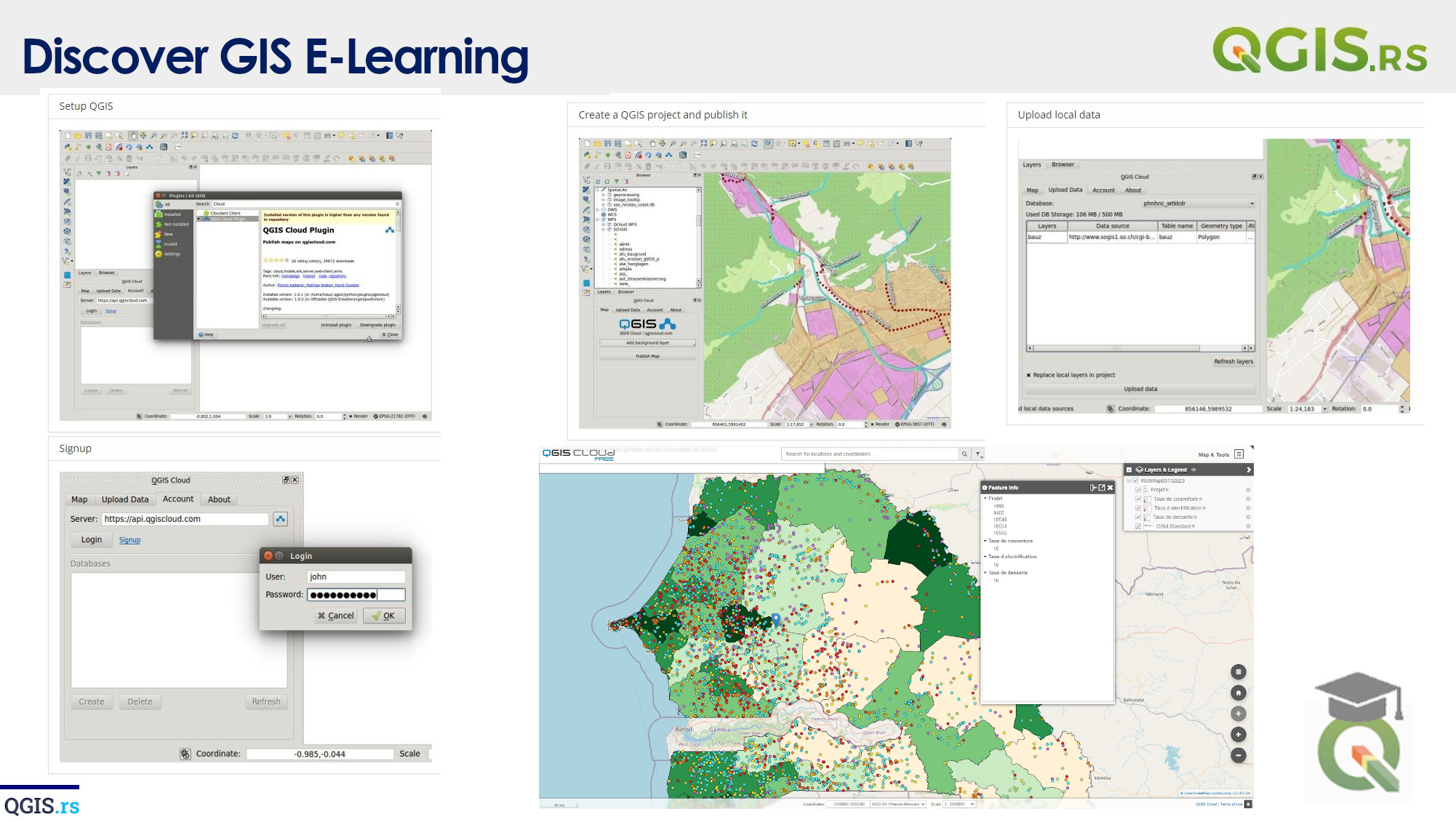
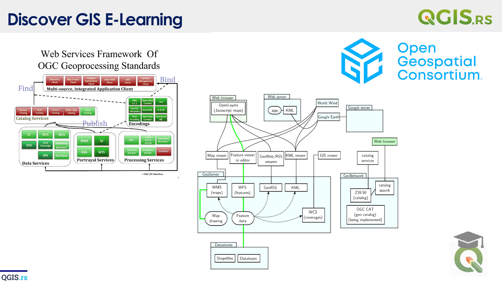
‘QGIS.rs’: Explore WFS services
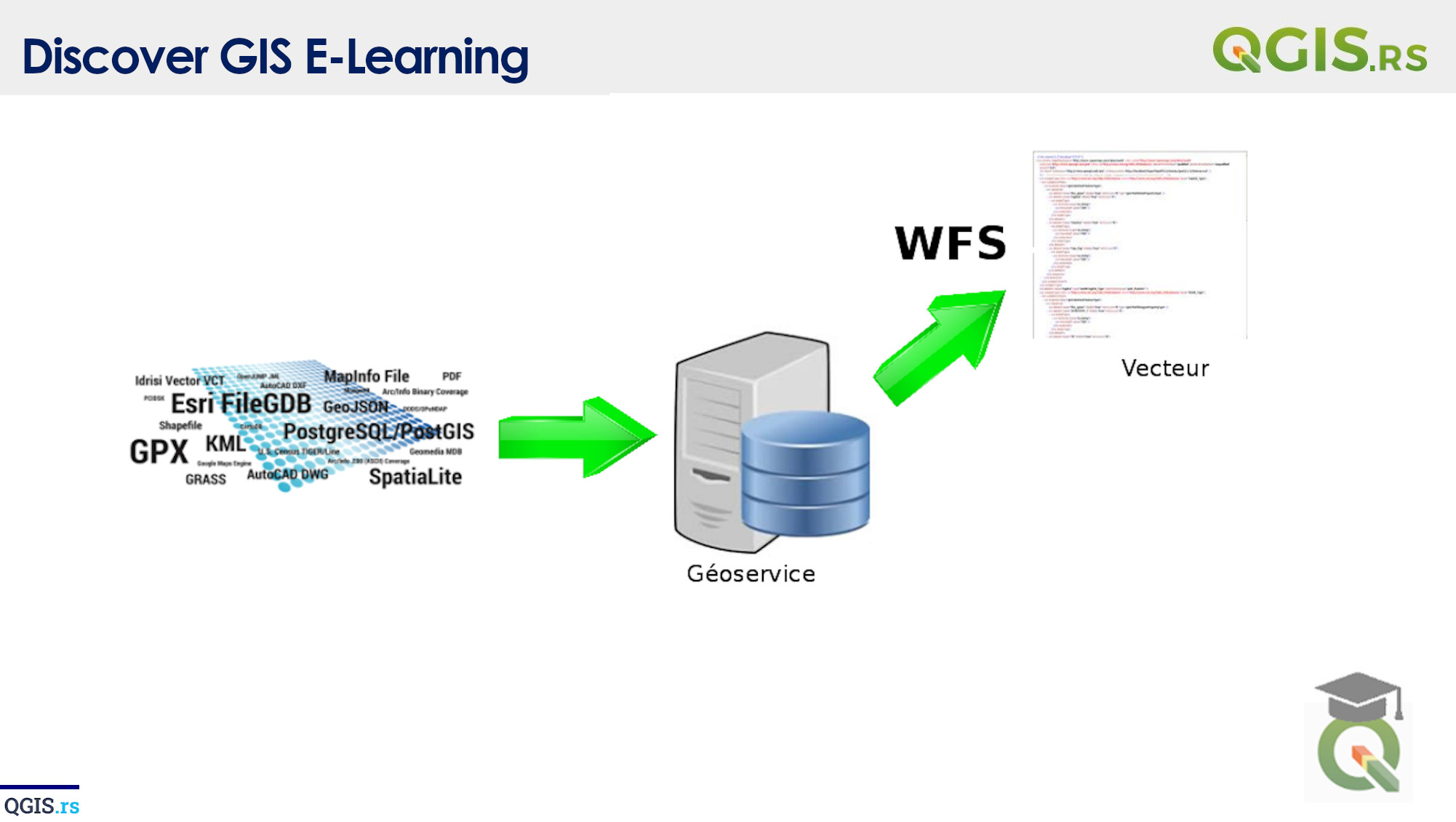
WFS Services or Web Feature Services provide a way to access vector data over the web. It is an OGC (Open Geospatial Consortium) standard that allows clients to retrieve and manipulate geographical features from a server. These features can be points, lines, and polyggon shapes that represent real-world features like buildings, roads, and rivers.
“GIS is the missing piece of the puzzle that can bring together all the pieces of the world's information.“ - ChatGPT
march 28, 2022
august 18, 2022
august 18, 2022
august 18, 2022
august 18, 2022
august 18, 2022
august 18, 2022