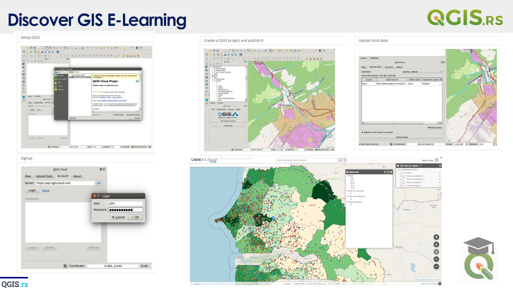
‘QGIS.rs’: Automated creation of a series of maps
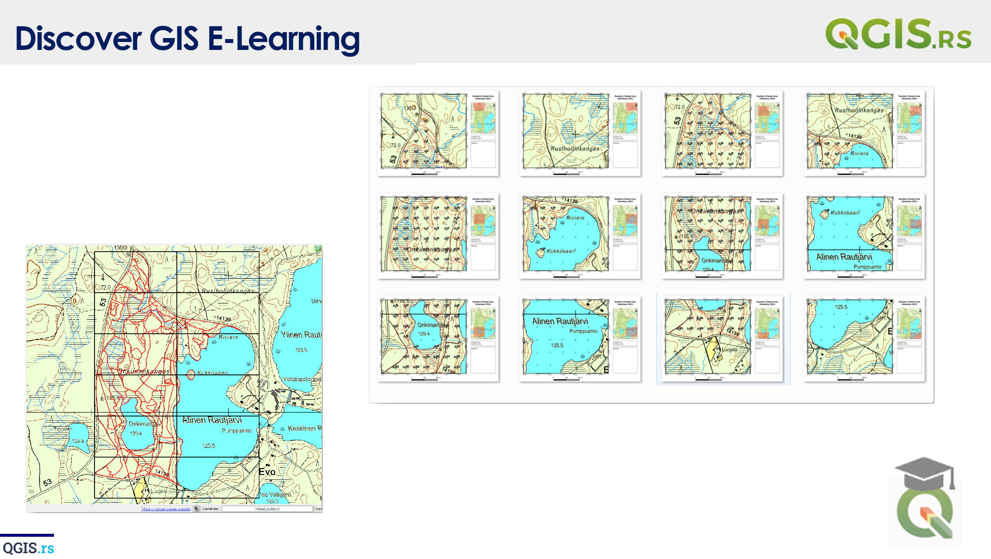
QGIS Atlas is a feature in QGIS that allows for the automated creation of a series of maps with changing extent and content. Atlas can be used to create maps for a series of regions, each with its own extent and its own set of map layers.
“A GIS is like a camera, it captures data and makes it visible.“ - David Maguire
march 28, 2022
august 18, 2022
august 18, 2022
august 18, 2022
august 18, 2022
august 18, 2022
august 18, 2022