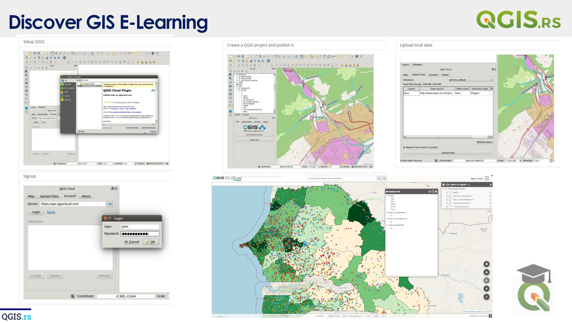
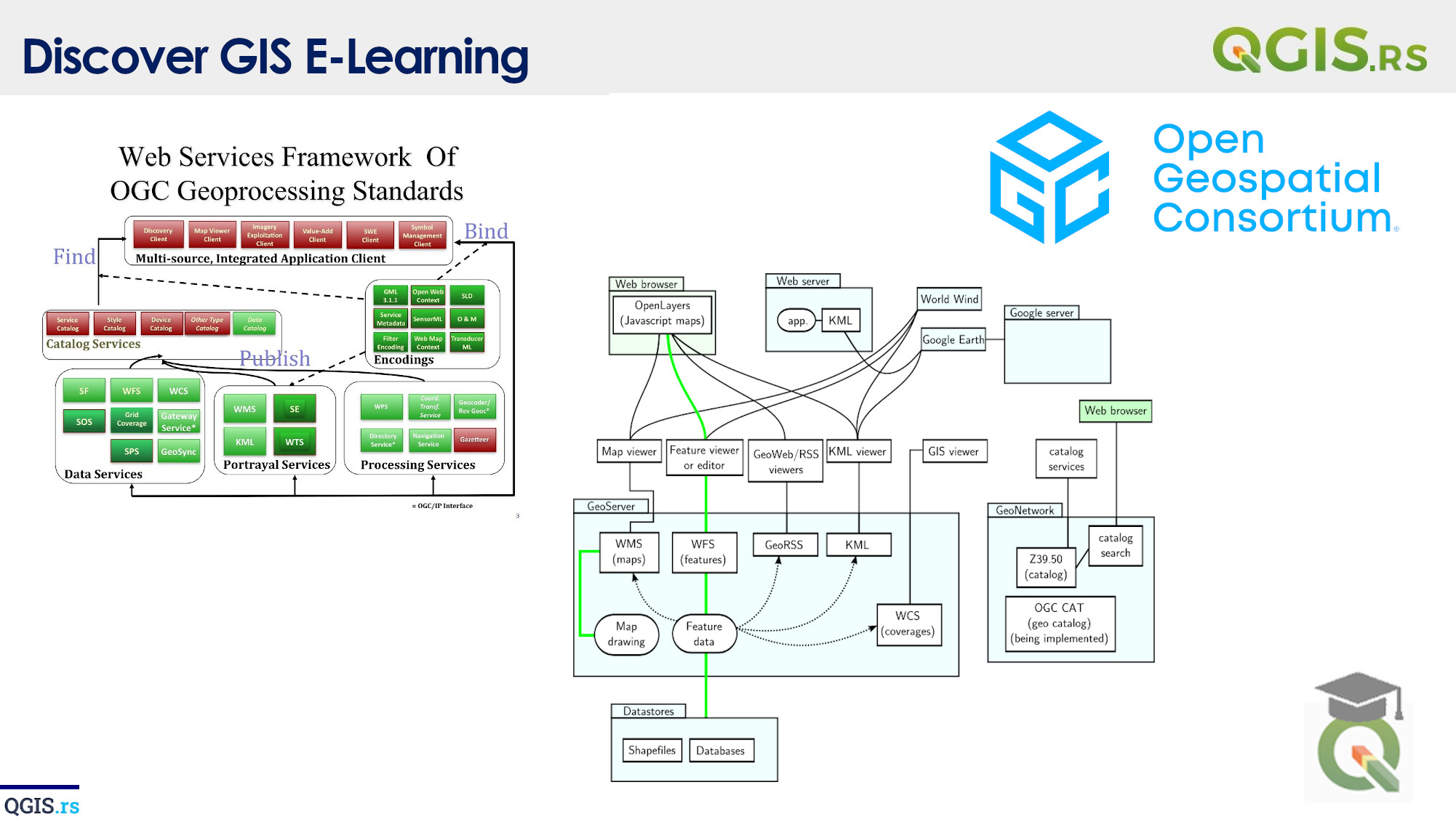
‘QGIS.rs’: Explore WCPS services
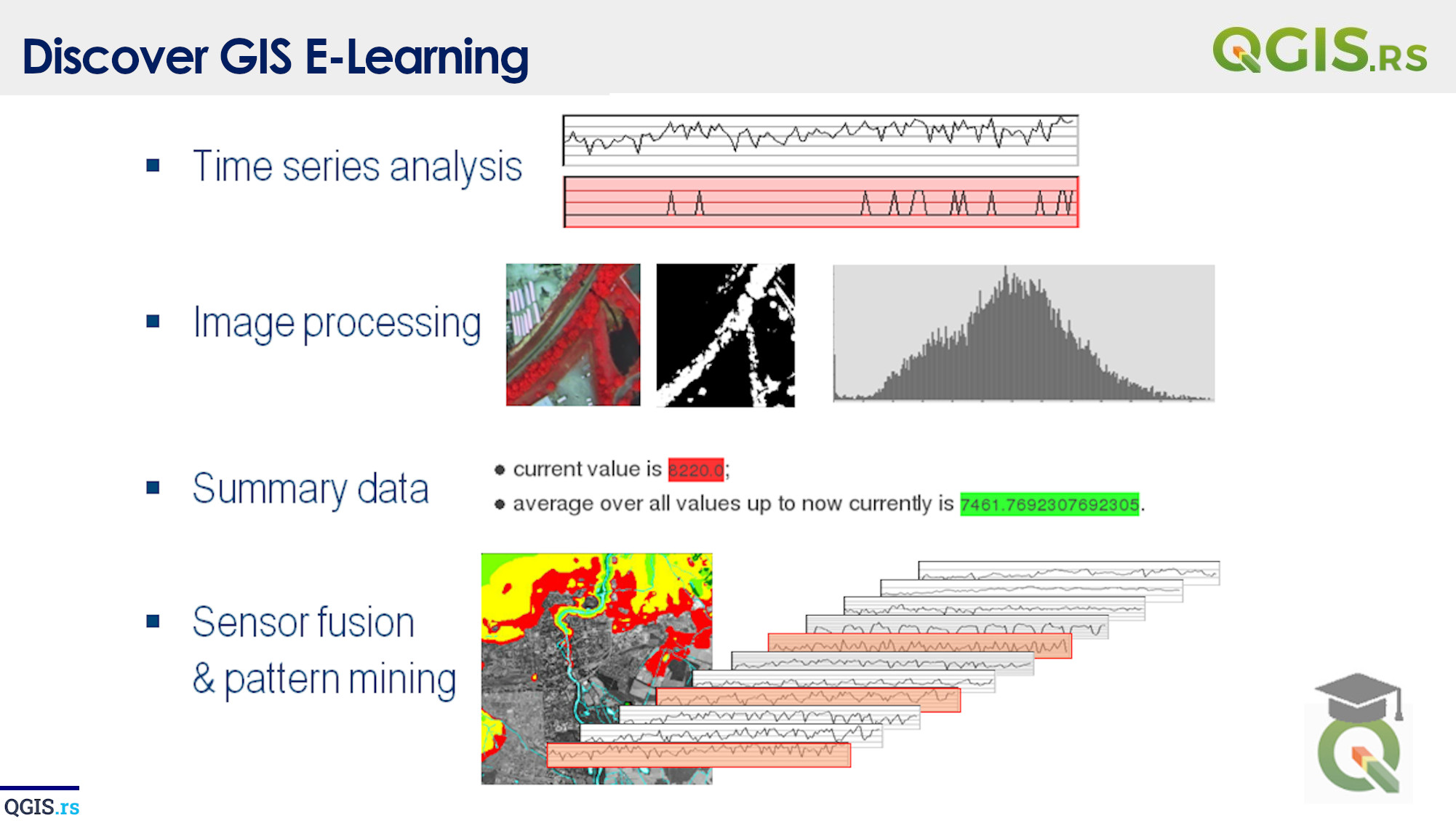
WCPS, or Web Coverage Processing Service, is a protocol for processing and analyzing geographic coverages or grids stored on a server. It is a standard of the Open Geospatial Consortium (OGC) and enables access to remote coverages through simple HTTP requests. WCPS provides a way to perform complex geospatial operations, such as filtering, aggregation, and extraction, on large datasets efficiently and in a scalable manner.
“GIS is a tool that can help us navigate the complex web of information that makes up our world.“ - ChatGPT
march 28, 2022
august 18, 2022
august 18, 2022
august 18, 2022
august 18, 2022
august 18, 2022
august 18, 2022