‘QGIS.rs’: Learn how to combine raster data in QGIS
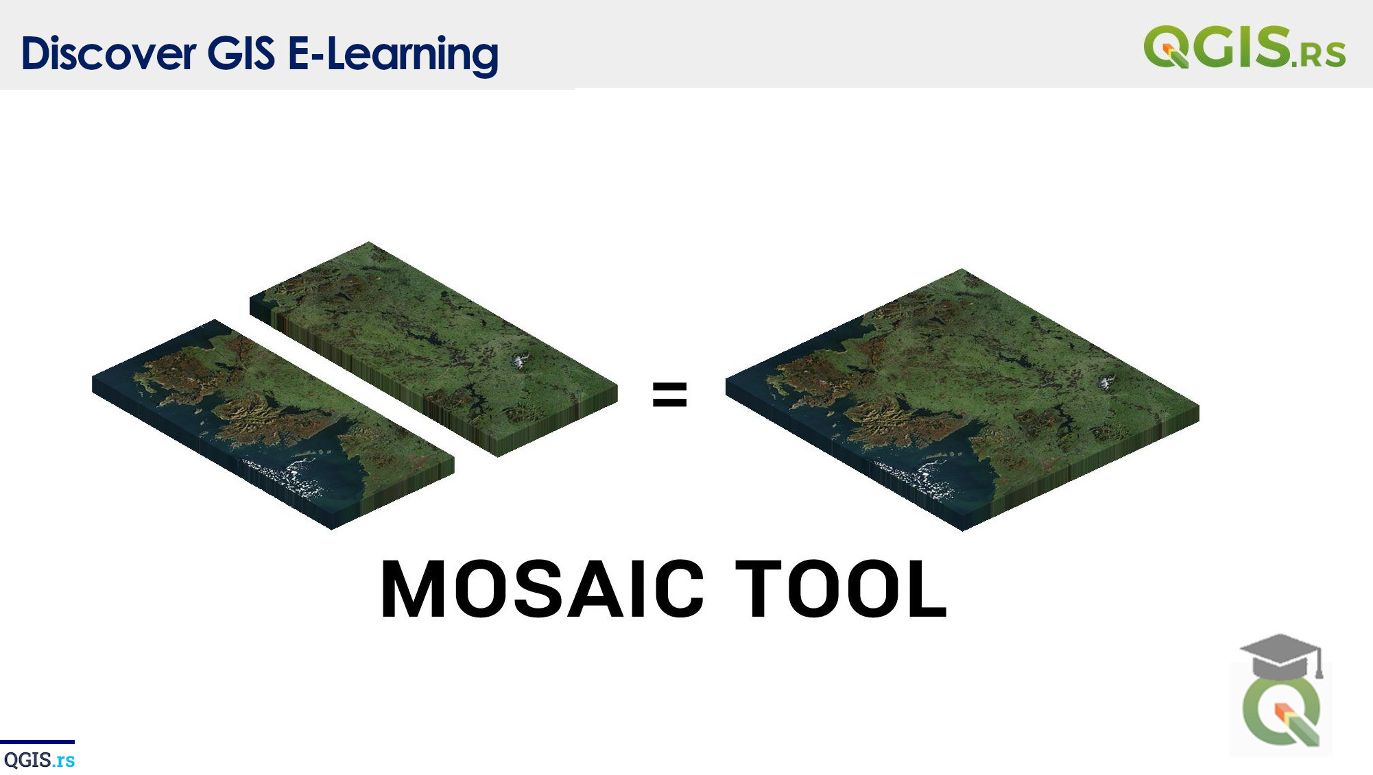
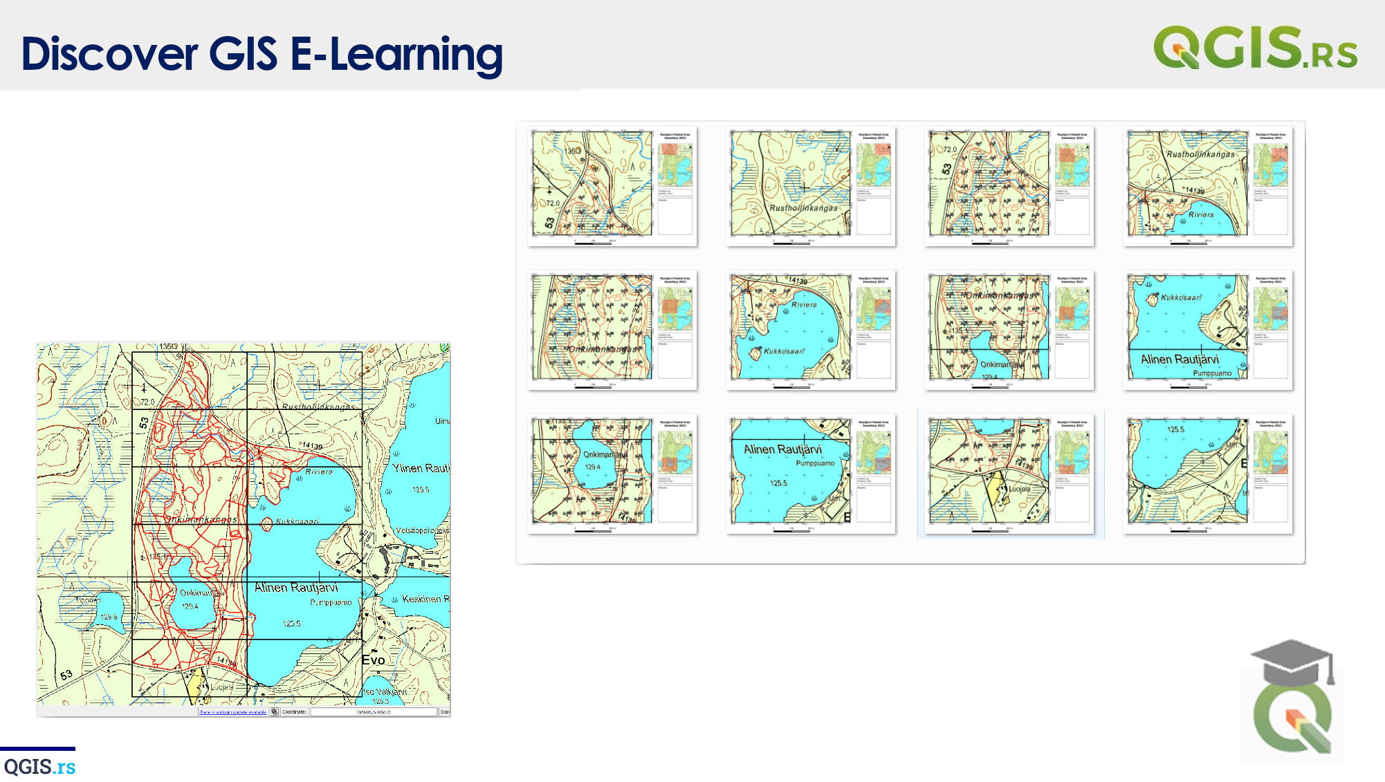
Raster Mosaicking is a process of combining multiple raster images into a single larger image. This technique is used to join two or more raster images into one, covering a larger area. This is helpful when you have multiple smaller images covering different regions and you want to combine them to create a single image for the entire region.
“A map is more than just a representation of space; it's a representation of reality.“ - J. B. Harley
march 28, 2022
august 18, 2022
august 18, 2022
august 18, 2022
august 18, 2022
august 18, 2022
august 18, 2022