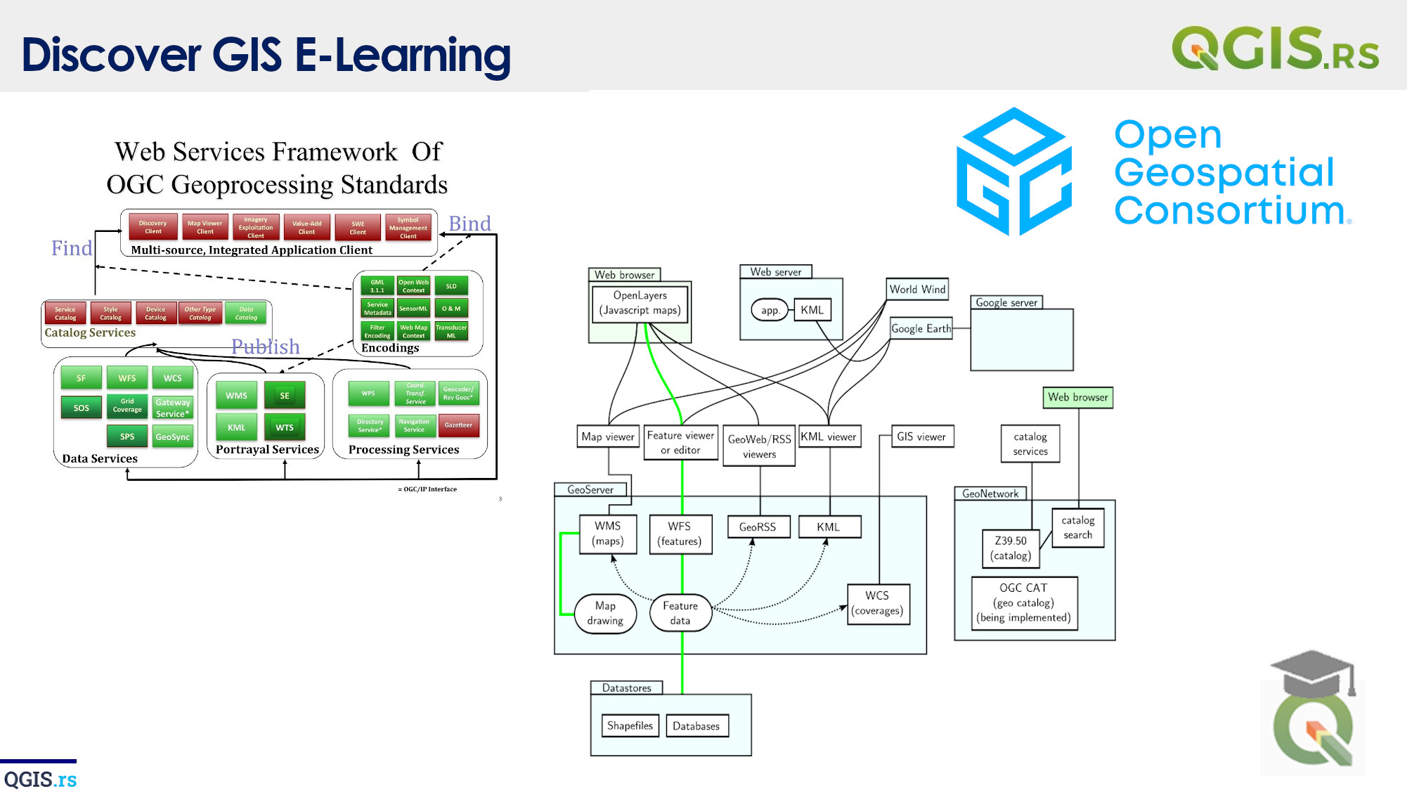
‘QGIS.rs’: Explore WCS services
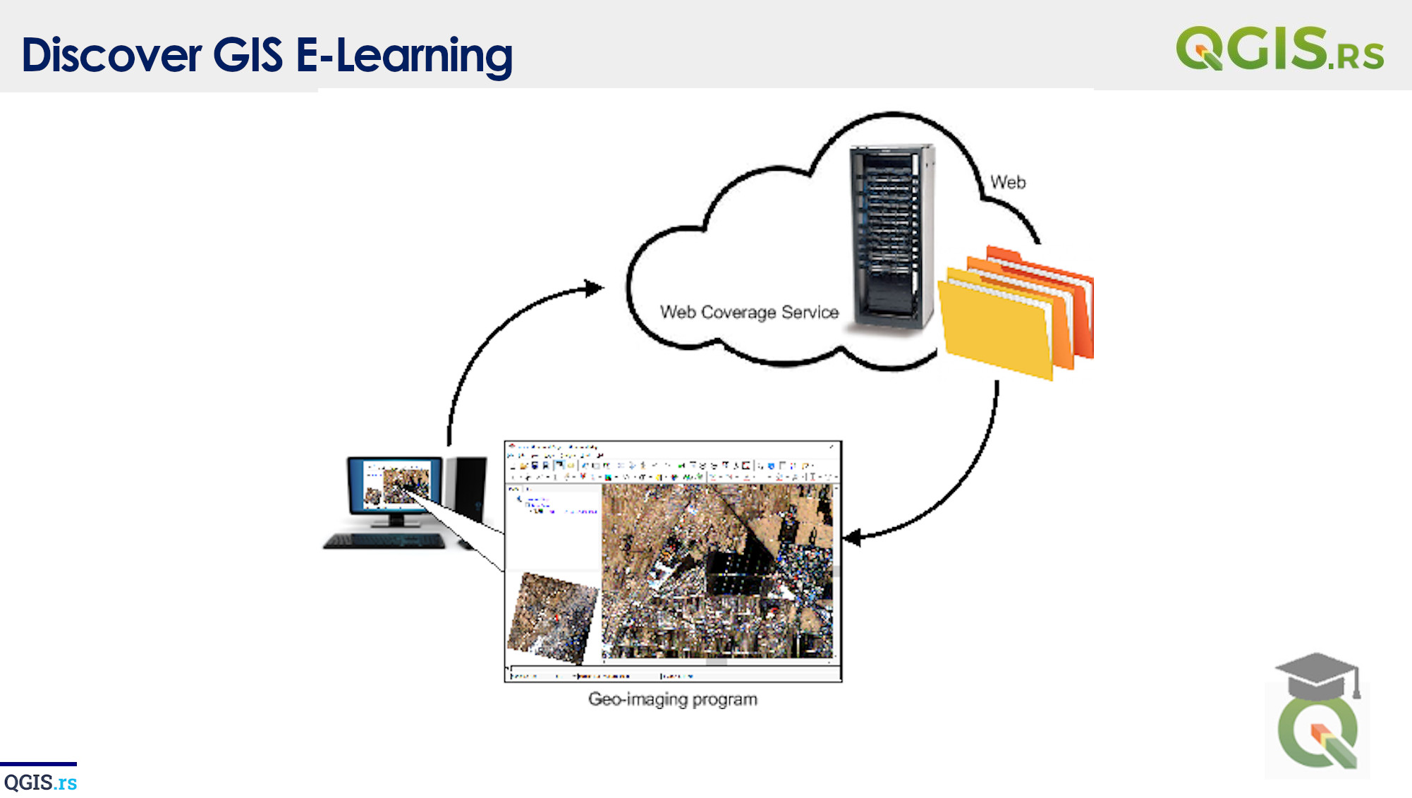
Today we are going to explore the world of Web Coverage Services (WCS), which is one of the Open Geospatial Consortium (OGC) standards for serving geospatial data. WCS provides access to coverages, which are defined as two-dimensional arrays of spatially-referenced data.
“GIS is a tool that can help us see the world with new eyes and understand our place in it.“ - ChatGPT
march 28, 2022
august 18, 2022
august 18, 2022
august 18, 2022
august 18, 2022
august 18, 2022
august 18, 2022