‘QGIS.rs’: Perform Union operations in QGIS
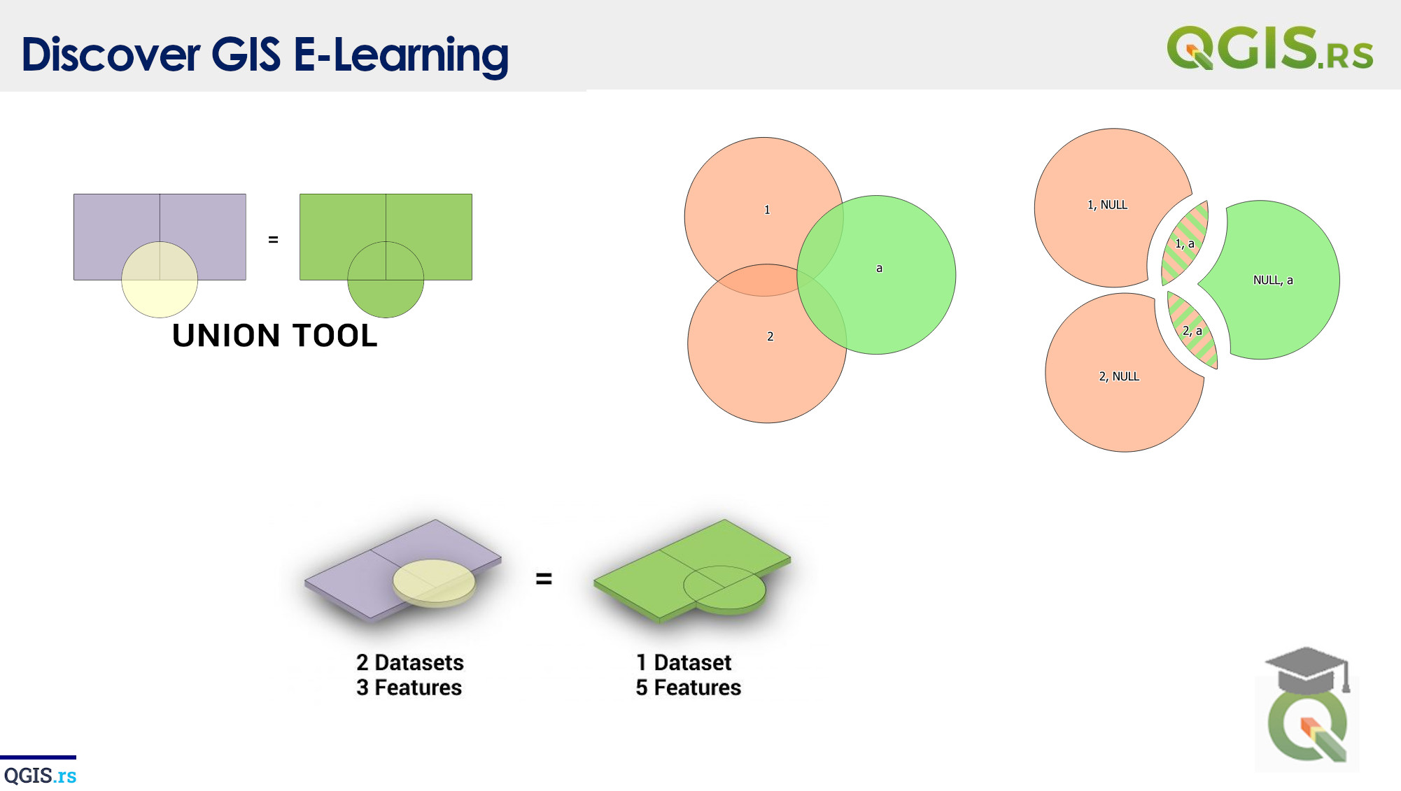
Union is a spatial analysis operation in GIS, which combines two or more layers into a single layer by creating a new layer that contains all of the features from each input layer. It’s like sticking together two pieces of paper, but for geographic features.
“GIS is a way of asking questions, finding answers and communicating the results.“ - Esri
march 28, 2022
august 18, 2022
august 18, 2022
august 18, 2022
august 18, 2022
august 18, 2022
august 18, 2022