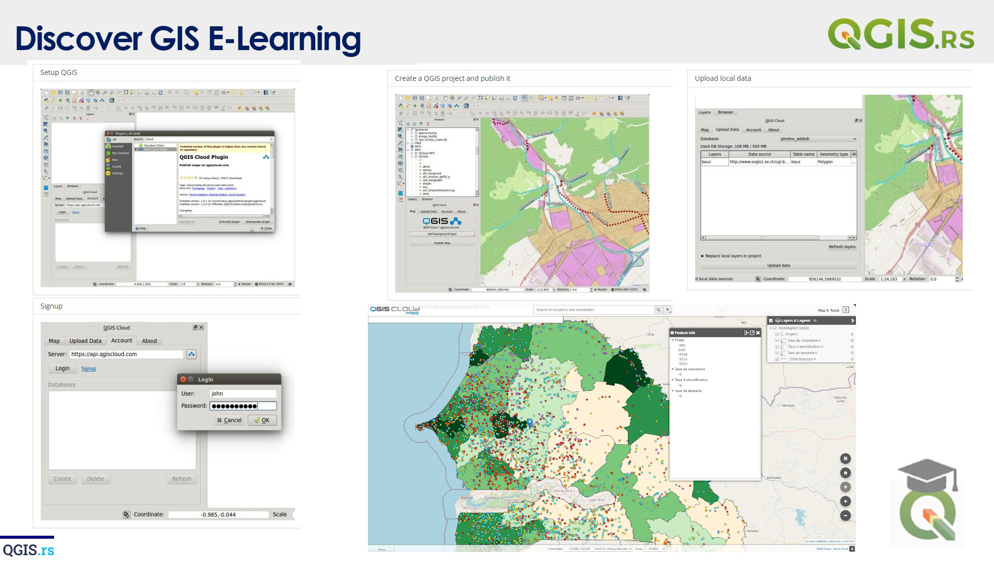
‘QGIS.rs’: Perform Difference operations in QGIS
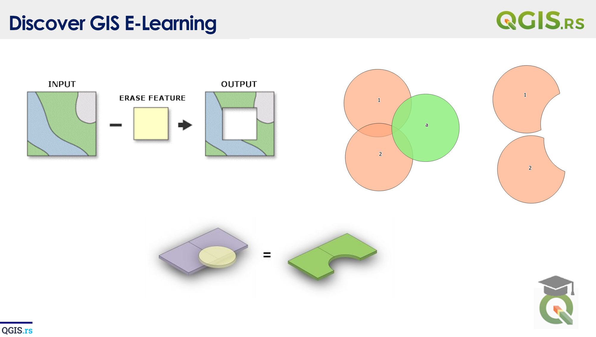
QGIS is a powerful open-source software used for handling and analyzing geographic data. One of its useful features is the “Difference“ tool, which allows you to compare two layers and create a new layer that shows the parts that are unique to one layer and not in the other. This tool can be used to identify changes in geographic features, such as land use or urbanization, over time.
“GIS helps us understand our place in the world and how we can make a difference.“ - ChatGPT
march 28, 2022
august 18, 2022
august 18, 2022
august 18, 2022
august 18, 2022
august 18, 2022
august 18, 2022