‘QGIS.rs’: Hilshade, add a depth of the data...
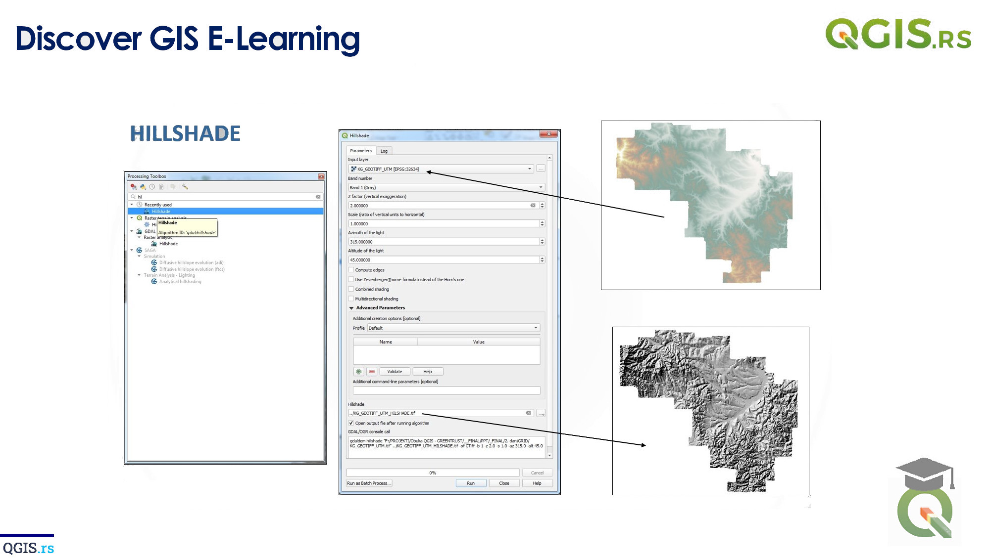
Hillshade is a 3D representation of a digital elevation model, or DEM, that allows us to visualize the relief of an area in a way that closely resembles how the land would look if we were viewing it from above. It is created by simulating the illumination of the terrain based on the position of the sun and the slope of the surface.
“Geographic information systems (GIS) have changed the way we think about the world.“ - Felipe Meneguzzi
