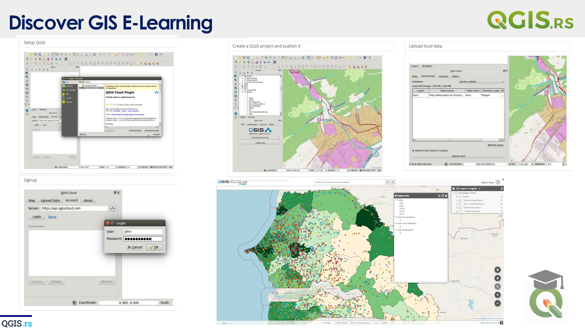
‘QGIS.rs’: Explore GIS components - Raster Data
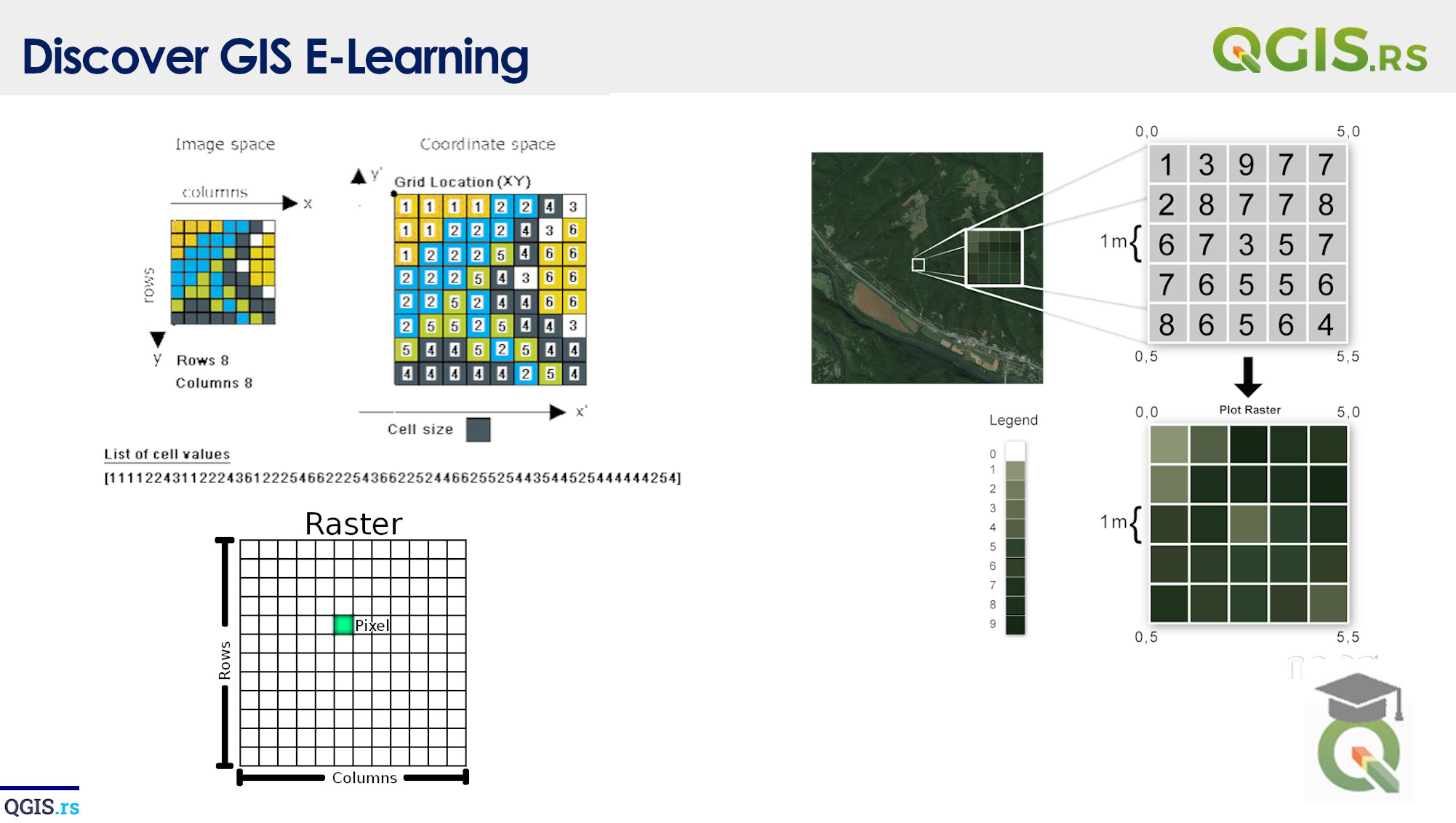
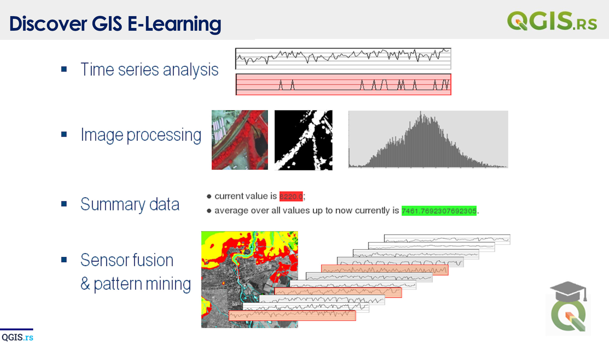
Let's Talk About the Building Blocks of GIS Maps! Raster data is one of the most important components of a GIS map. It's made up of pixels, and each pixel represents a continuous surface such as a digital elevation model or a satellite image. Raster data is useful for representing information that changes continuously across a surface, such as temperature, rainfall, or elevation.
“Every map represents a point of view, a perspective on the world.“ - Alastair Bonnett
march 28, 2022
august 18, 2022
august 18, 2022
august 18, 2022
august 18, 2022
august 18, 2022
august 18, 2022