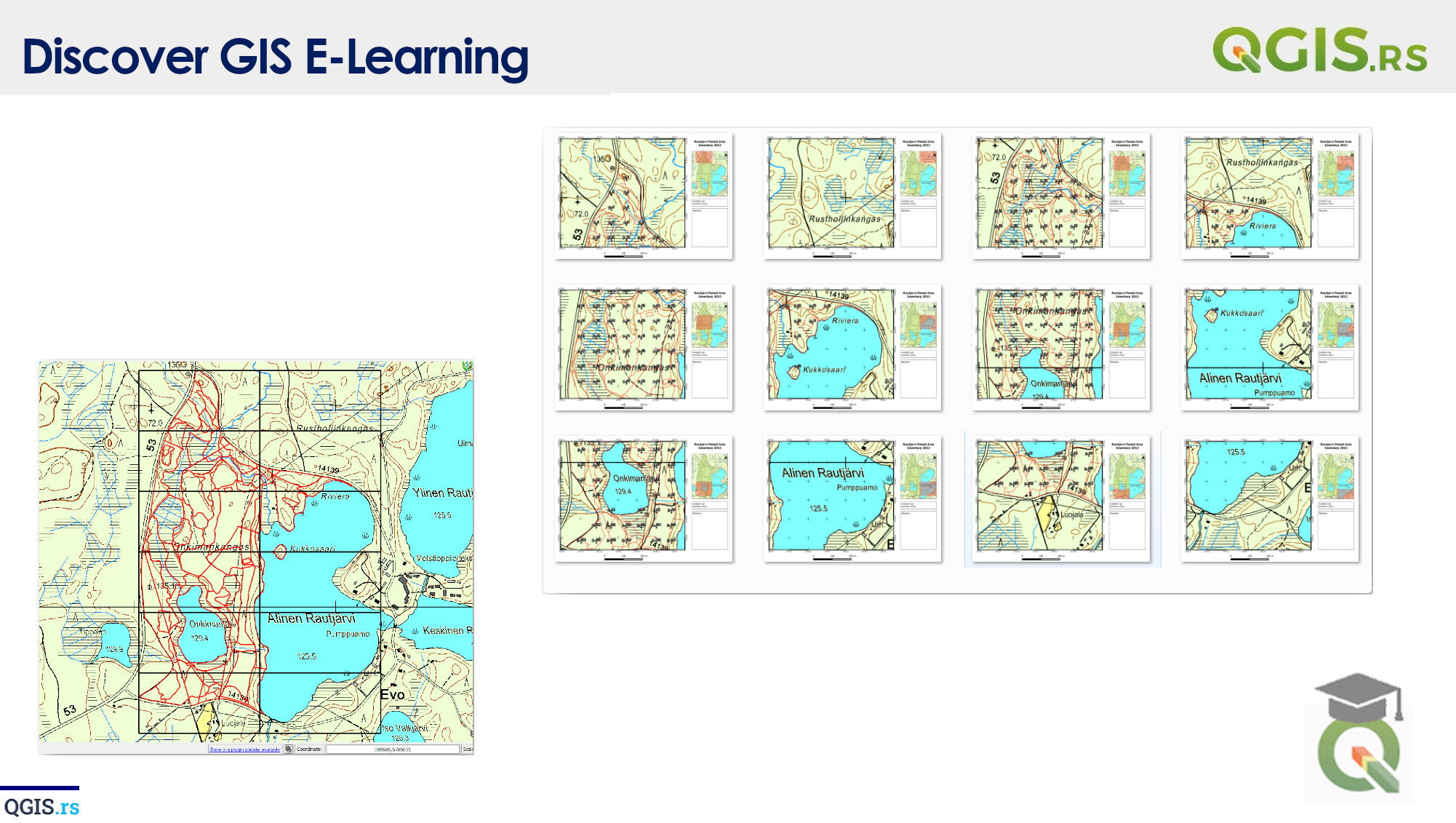
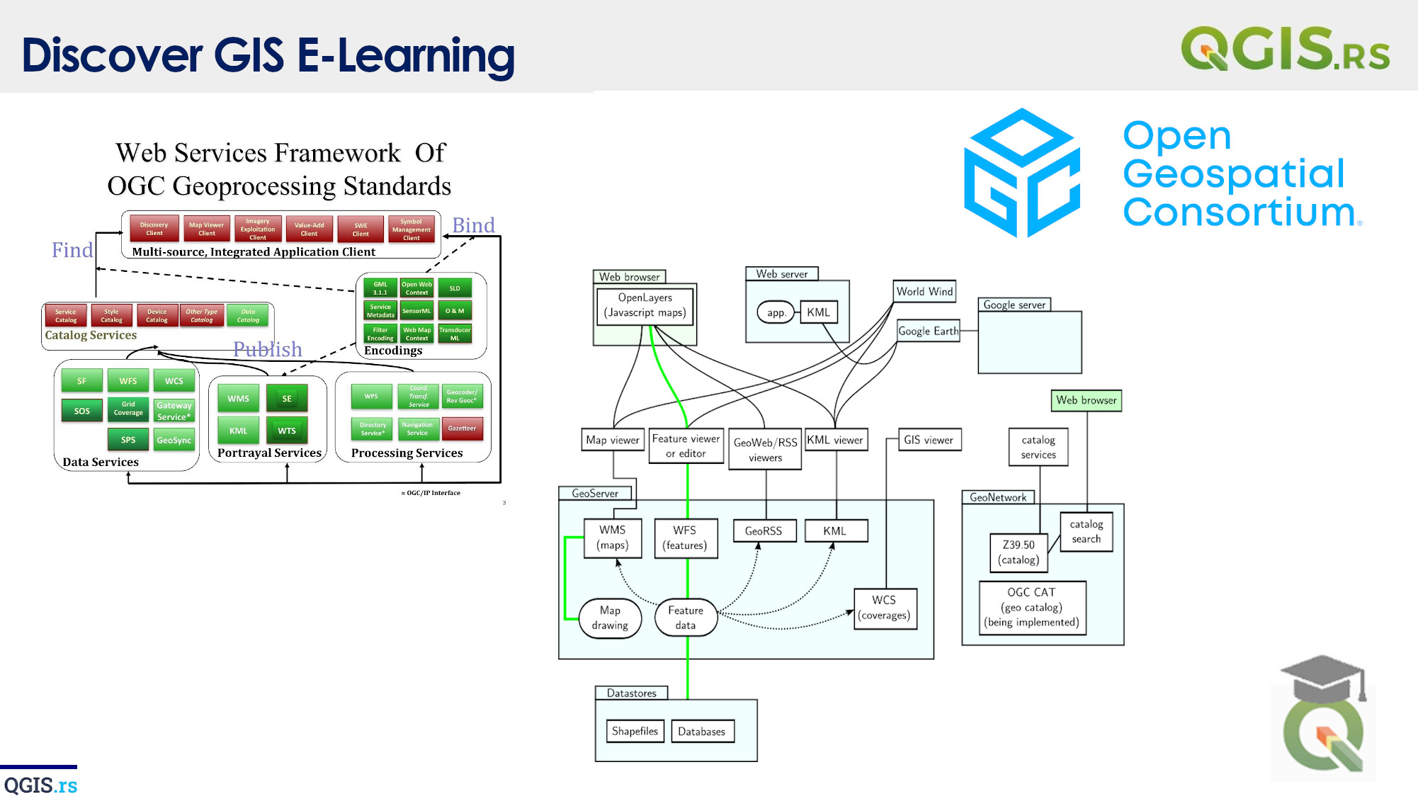
‘QGIS.rs’: Explore GIS components - Desktop GIS

Desktop GIS refers to geographic information system (GIS) software that is installed on a local computer and run on a desktop or laptop. It is a standalone GIS software solution that allows users to create, edit, visualize and analyze geospatial data. Some of the most commonly used desktop GIS software include ArcGIS, QGIS, and MapInfo.
“GIS is a powerful tool that can help us tackle some of the world's most pressing challenges.“ - ChatGPT
march 28, 2022
august 18, 2022
august 18, 2022
august 18, 2022
august 18, 2022
august 18, 2022
august 18, 2022