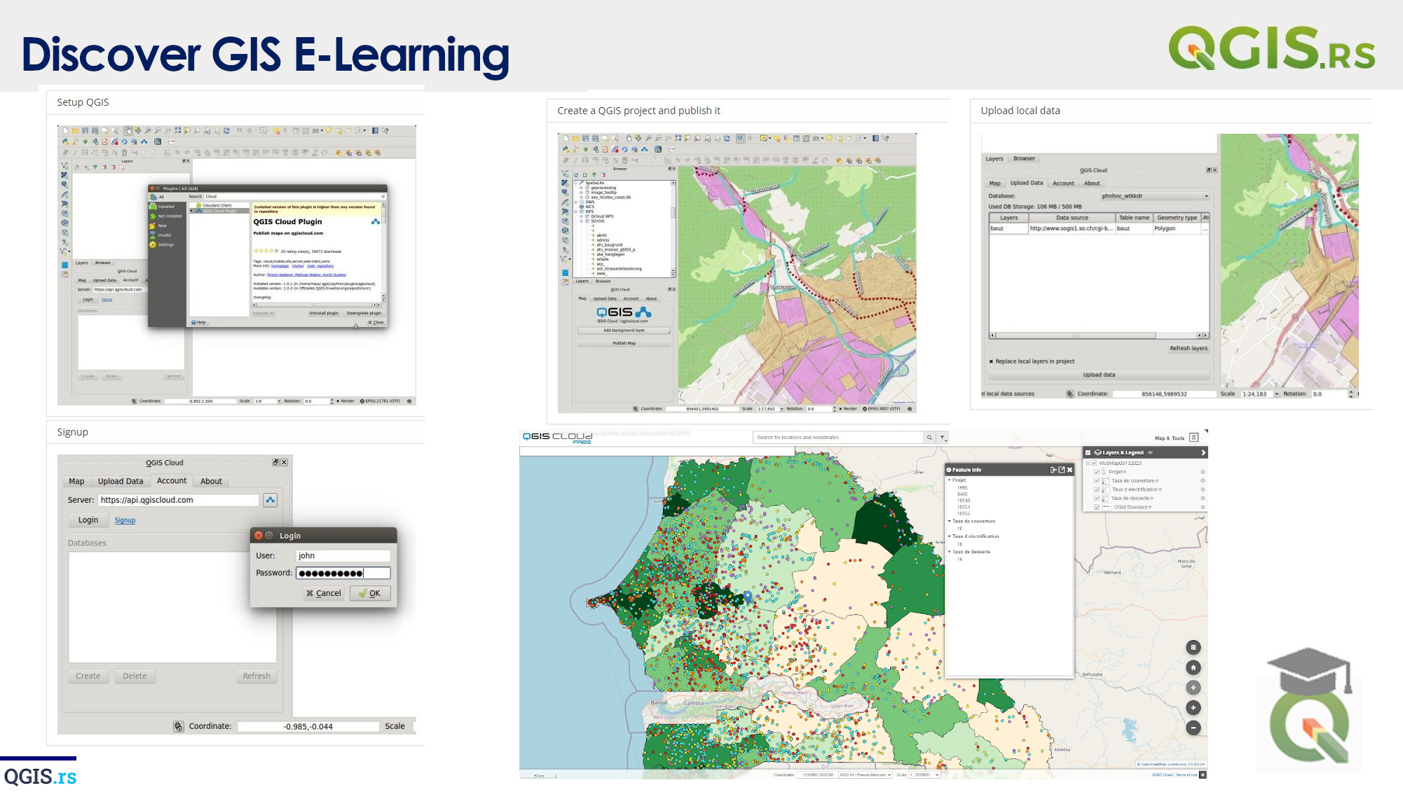
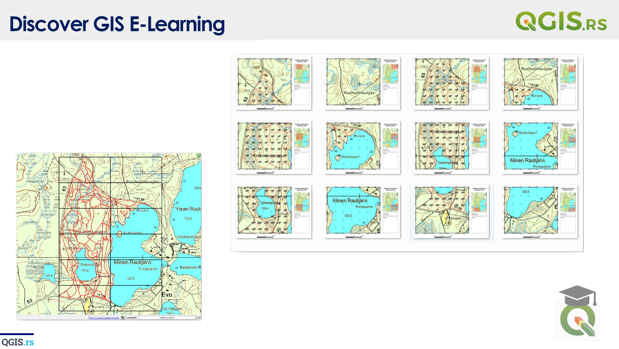
‘QGIS.rs’: What are contours, how do we create them and what do they show us
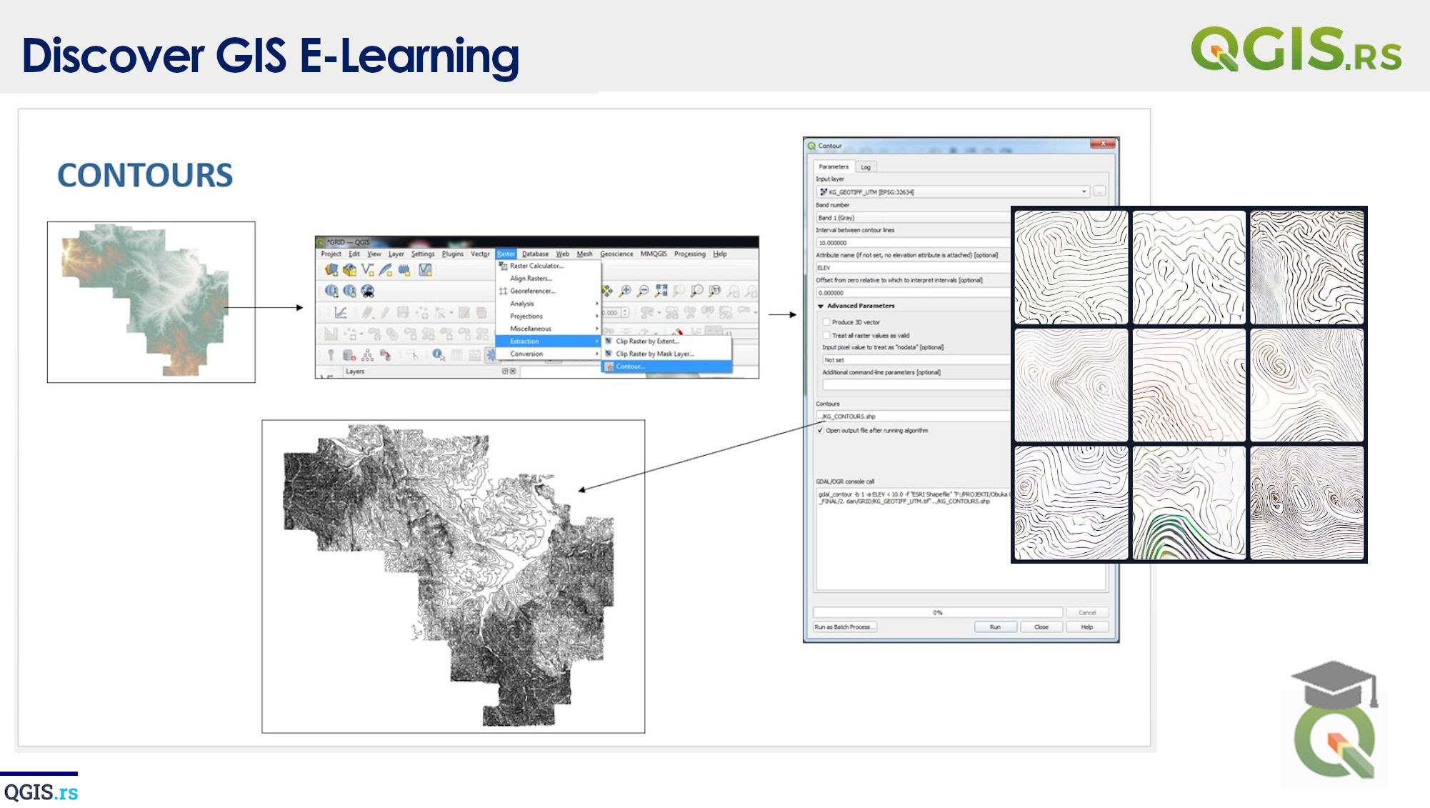
Contours are lines that join points of equal height or value. In the context of GIS, they are commonly used to represent elevation, temperature, or other continuous variables. Contours help us visualize 3D terrain information in a 2D map and enable us to analyze and compare different areas based on their physical attributes.
“GIS is a tool that can help us make sense of the world and see beyond the surface.“ - ChatGPT
march 28, 2022
august 18, 2022
august 18, 2022
august 18, 2022
august 18, 2022
august 18, 2022
august 18, 2022